
The Copernicus Imaging Microwave Radiometer
A Copernicus Satellite to Support the integrated EU policy for the Arctic
Craig Donlon (craig.donlon@esa.int), P. Laberinti, F. Vanin, R. Midthassen, M. Tossant, B. Fiorelli, ESA-ESTEC, The NetherlandsT. Lavergne (METNO, Norway), J. Hoeyer and Tonboe (DMI, Denmark) Adapted from a poster at the GHRSST XIX conference (4-8 June 2018)
Introduction
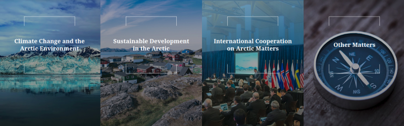
The Arctic’s fragile environment is a direct and key indicator of climate change. This Requires specific mitigation and adaptation actions in three priority areas:
-
Climate Change and Safeguarding the Arctic Environment (livelihoods of indigenous peoples, Arctic environment).
-
Sustainable Development in and around the Arctic (exploitation of natural resources e.g. fish, minerals, oil and gas), “Blue economy”, safe and reliable navigation (e.g. the Arctic Northern Sea Route).
-
International Cooperation on Arctic Issues (scientific research, EU and bilateral cooperation projects, fisheries management/ ecosystems protection, commercial fishing).
Security Policy issued to the European Parliament and the Council, on 27 April 2016,
a joint communication that proposed "An integrated European Union policy for the Arctic"
In recent years, the Arctic's role in climate change has become much more prominent - the Arctic is warming at almost twice the global average rate. Whereas in the past attention focused almost solely on the effects of climate change in the Arctic, there is a growing awareness that feedback loops are turning the Arctic into a contributor to climate change. Understanding these dynamics, and helping to develop specific strategies to mitigate and adapt to climate change in the Arctic, form part of the EU’s wider efforts to combat climate change. Under the UNFCC agreements.
The EU will promote sustainable development in the Arctic, taking into account both the traditional livelihoods of those living in the region and the impact of economic development on the Arctic's fragile environment. Adaptation strategies are needed to help Arctic inhabitants respond to the serious challenges they face because of climate change.
In view of increasing vessel traffic in the Arctic, the EU will contribute to enhance the safety of navigation in the Arctic by monitoring of spatial and temporal development of maritime activities in the Arctic; such knowledge is essential to assess the consequent risks and make better decisions on possible mitigating measures.
Given the important role of Arctic as a regulator for the climate of the planet and acting as a sink for long-range pollution, the EU has a duty to protect the Arctic environment and strengthen ecosystem resilience.
Since 1978 satellite microwave radiometers have provided a long-term, consistent, and reproducible climate data record of floating sea ice parameters. Poor spatial resolution and uncertainty regarding the continuity of low-frequency (i.e. < 18GHz) capability are concerns.
To address the Integrated European Arctic Policy, a sustainable European operational provision of medium-resolution (5-10 km) multi-frequency and multi-polarization microwave radiometer observations delivering all-weather Sea Ice Concentration (SIC), Sea Surface Temperature (SST) with AMSR-2-like (or better) capability is required.
CIMR User Needs
The cryosphere is considered as a ‘natural climate-meter’ that is responsive to several key variables (e.g. AR-5). The Arctic amplifies climate perturbations and is particularly sensitive area dominated by the Arctic Ocean, Greenland and the surrounding land mass.
Sea Ice Concentration (SIC) describes the relative amount of area covered by ice, compared to a reference area. SIC is the most important parameter for operational navigation in sea-ice infested waters and for climate services and a core measurement underpinning the EU Arctic Policy. SIC is required at a high spatial resolution (< 5km) and with sub-daily coverage of the Arctic regions with improved spectral and radiometric fidelity compared to existing satellite capability.
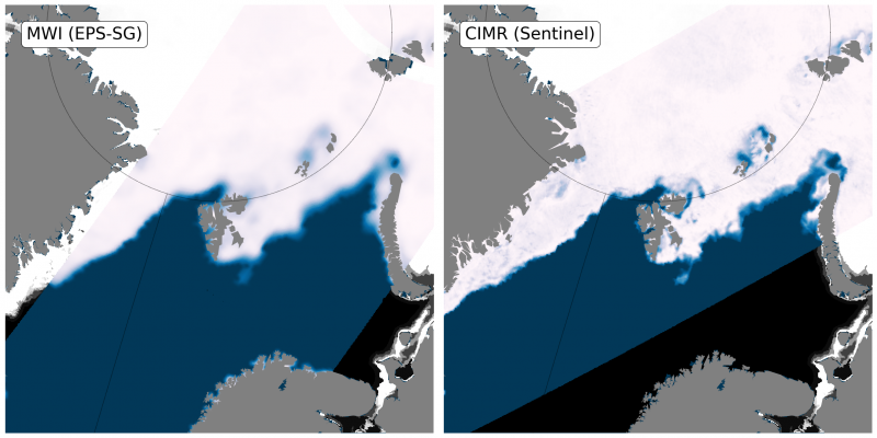
The MWI case is simulated with SSMIS while CIMR is simulated with AMSR2
and highlights the need for high (<5 km) spatial resolution data for MIZ monitoring.
As sea ice retreats, all-weather Sea Surface Temperature (SST) is required to monitor the Arctic ocean surface dynamics - for climate modelling, mesoscale analysis, oceanic predictions and as climate change indicator in its own right. The prevalence of clouds limit the effectiveness of high-resolution (~1km) infrared satellite missions resulting in poor revisit. Microwave radiometers operating in the 6-11GHz frequency are unaffected by clouds and can address this issue directly. But measurements must be provided at spatial resolutions much higher than the current generation of instruments (e.g. AMSR2 has a 6.9 GHz beam-field of view 62 x km in size). The challenge is to provide SST measurements using a 6.9 GHz beam field-of view <15 km. SST is required at a high spatial resolution to implement the integrated EU Policy for the Arctic.
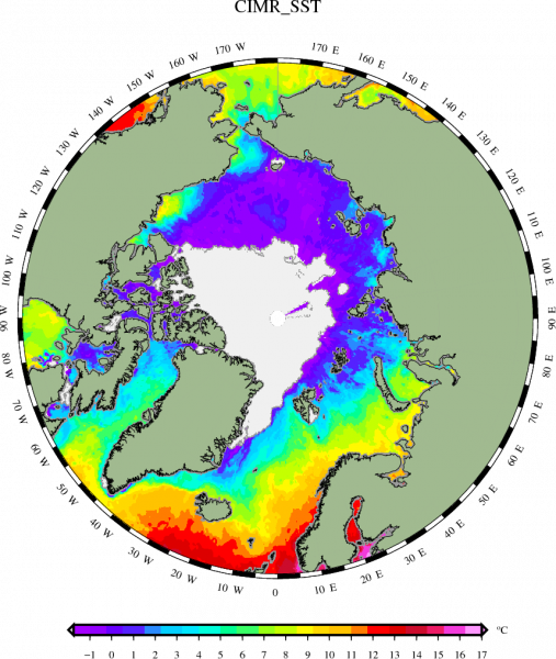
This coverage is out-of-reach when using only Infrared radiometry (e.g. Sentinel-3).
This capability is required to implement the integrated EU policy for the Arctic.
See also here.
The Integrated EU policy for the Arctic requires a holistic measurement approach to effectively monitor its’ implementation. The use of existing Copernicus and International satellite measurements in synergy is essential. For example CIMR will support Sentinel-1 SAR for sea ice mapping and Sentinel-3 for SST mapping. The challenge is to bring the resolution of CIMR to below 5km to enable using CIMR, S3 TIR and S-1SAR jointly A microwave radiometer having high spatial resolution, radiometric accuracy and spectral capability - tuned to the needs of the Arctic Policy - has immense potential for critical applications in the high latitudes. For example: Ice Type mapping, snow parameters over ice and over land, ice surface temperature, sea surface salinity, extreme winds over ocean waters, rain rate, soil moisture and permafrost, cloud liquid water vapour. Currently there is a risk that after AMSR-2 low-frequency capability will be lost.
The user needs for the CIMR mission are diverse.
This is an asset because it underlines the importance of the CIMR mission to address the urgent needs of the user community in the Arctic as set out in the Integrated EU Policy for the Arctic.
CIMR Mission Aim and Objectives
The aim of the Copernicus Imaging Microwave Radiometry (CIMR) Mission is to:
Provide high-spatial resolution microwave imaging radiometry measurements and derived products with global coverage and sub-daily revisit in the Polar regions to address Copernicus user needs and the EU Integrates Policy for the Arctic.
The Primary objectives of the CIMR mission are to:
- Measure all-weather Sea Ice Concentration (SIC) and Sea Ice Extent (SIE) at a spatial resolution of =<5 km, with a standard uncertainty of =<5%, and sub-daily coverage of the Polar Regions and daily coverage of Adjacent Seas.
- Measure all-weather Sea Surface Temperature (SST) at an effective spatial resolution of =<15 km, with a standard uncertainty of =<0.2 K and focussing on sub-daily coverage of Polar Regions and daily coverage of Adjacent Seas Ensure improved continuity of AMSR-type capability in synergy with other missions (eg. MetOp-SG(B)).
- Ensure improved continuity of AMSR-type capability in synergy with other missions
Secondary Measurement objectives include:
Sea Ice Drift (≤25 km, 3 cm/s), Thin Sea Ice Thickness (~40 km, 10%), Snow on Sea Ice, Snow Water Equivalent, Sea Surface Salinity (~40 km), Ice Type (≤5 km), Extreme Wind. Additional tertiary products (e.g. global soil moisture, water vapour, precipitation rate…)
See also the Mission Requirement Document (MRD v1.5) for CIMR in our Documents section.
CIMR Preliminary Concept
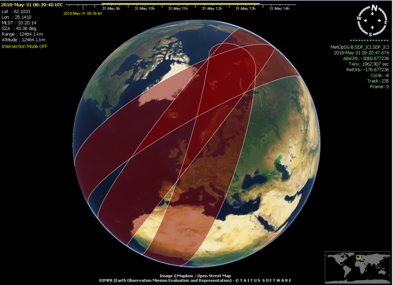
Following extensive study of different concepts since 2010 (scanner, interferometer, push-broom, focal-plane array), ESA together with European Industry has converged on a preferred solution based on performance requirements and technical constraints. The CIMR mission will embark a multi-frequency imaging microwave radiometer payload to measure the brightness temperature of the upwelling microwave radiation at different frequencies. Given that MetOp-SG(B) MWI has a wide-swath capability with channels of 18.7 GHz and above, CIMR is focused on the low frequency domain (1.4-36.5GHz) and is complementary to MWI. Accordingly, CIMR is designed to fly in loose convoy with MetOp-SG(B) that provides a unique capability including MWI and ICI radiometer and SCA scatterometry. In this way, CIMR leverages European assets in a collaborative manner with EUMETSAT to address the Integrated EU Policy for the Arctic.
The CIMR swath is >1900km and will ensure that there is no “hole at the pole” in coverage.
Revisit for the Arctic region is sub-daily with a large proportion of the region imaged every 6-12 hours.
CIMR in brief:
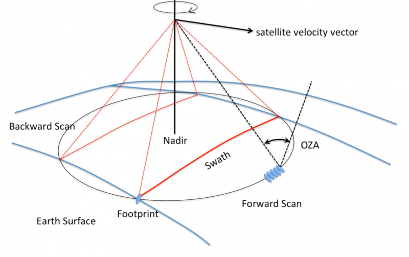
- Conically scanning multi-frequency microwave radiometer
- H &V channels at 1.4, 6.9. 10.65, 18.7 and 36.5 GHz
- High Spatial resolution (6.9&10.65 GHz @<15 km, 18.7 & 36.6 GHz @< 5 km)
- Single satellite, Observation Zenith angle 55±1.5°
- Loose convoy flight with MetOp-SG(B) <360s separation
- ~95% global coverage every day, mean 6 hourly-revisit in Arctic Areas
- In Phase A/B1, Launch: 2025
CIMR Status (early June 2018)
A Preliminary Concept for CIMR is being studied at Phase A/B1 in parallel by two Consortia (AIRBUS UK, and Thales Alenia Space Italy). Shown below is a generic concept for the CIMR concept building on the ESA Microwat studies. A large ~7m rotating mesh antenna is required to deliver the relatively high spatial resolution required from CIMR. Rotation rates must be managed carefully to minimize Angular Momentum forces which will require multiple feed arrays.
The final configuration of CIMR will be decided based on an assessment of all designs and configurations proposed for CIMR in 2019.